Digital Orienteering Map Archive for Colm Hill
|
Zaloguj
Wszyscy użytkownicy
|
Język:
Polski
Česky
Dansk
Deutsch
Eesti
English
Español
Français
Italiano
Magyar
Norsk
Polski
Português
Русский
Svenska
Türkçe
Український
|
DOMA 3.0.10
Pokaż podgląd map
Ukryj podgląd map
|
KML
|
Powrót
<< WOCT Etape 3 (11/08/2010)
|
CISM Model (17/08/2010) >>
WOCT Etape 4 (13/08/2010)
Kategoria:
Maps
Mapa/teren:
Granasen-vest
Organizator:
WOC
Kraj:
Norway
Konkurencja (dystans):
Middle
Wyniki
Dystans:
6.1 km
Czas:
36:34
Średnie tętno:
176
Maksymalne tętno:
190
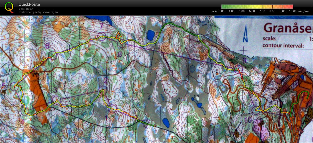
I wanted to run aggressively and i did. Bit hesistant in a few places (5, 7) and a big error at 8. I dropped too far down the slope, I have to pay more attention to my height, 2:30 lost. Also direction veir on the way to 11. Apart from that pretty happy.
Pokaż komentarze
Ukryj komentarze
(
0
)
Dodaj komentarz
Nazwa:
E-mail:
Zapisz
 Polski
 Česky
Česky Dansk
Dansk Deutsch
 Eesti
Eesti English
 Español
 Français
 Italiano
 Magyar
 Norsk
Norsk Português
 Русский
 Svenska
 Türkçe
 Український